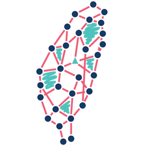
臺灣捷運與輕軌站點相鄰網絡(CPTOND-2025)
Taiwan metro and light-rail stop-adjacency network (CPTOND-2025)
CPTOND-2025 公共運輸路網資料集中的臺灣捷運網絡,收錄於 Netzschleuder 網絡目錄。節點是捷運與輕軌車站,有向連結表示某條路線在一站之後緊接停靠另一站,權重為經過該路段的路線數,並附車站經緯度與路段長度。網絡同時包含臺北、臺中與高雄的系統,彼此不相連。站名為簡體字,英文站名為機器翻譯。本站只提供連結。
重點資訊
- 結構
- 圖(網絡),有向,加權(經過該路段的路線數(edge 屬性 num_routes);另有路段長度 distance(公里),單位 routes),空間:節點座標 圖(網絡)有向加權空間
- 節點代表
- 捷運或輕軌車站(上游依路線去重後的站點)
- 連結代表
- 某條路線在車站 i 之後緊接停靠車站 j;權重為經過該路段的路線數
- 規模
- 約 225 個節點、約 465 條連結 (約略值,2026-11-04 查核)
- 時間範圍
- 2025-06(上游於 2025 年 6 月蒐集路線與站點。)
- 空間範圍
- 臺灣
- 領域
- 交通與移動
- 與臺灣的關係
- 網絡由臺灣臺北、臺中與高雄的捷運與輕軌車站及路段組成。 (大型資料集中的臺灣部分、描述臺灣的人、地方、組織或物種)
上游 CPTOND-2025 收錄中國大陸、香港與澳門城市的公車與捷運網絡,另有一個臺灣捷運網絡。 Netzschleuder 把它列在「Bus and metro networks of Chinese cities」條目下、網絡名為 taiwan_metro,圖屬性 city_cn 寫作「台湾省」,條目說明寫「around Taipei」,但實際也含臺中與高雄。本站以中性方式稱為臺灣捷運網絡。取用時在條目頁選 taiwan_metro 這一列的檔案(csv.zip、gt.zst、xml.zst 或 gml.zst),不必下載 figshare 上 2.16 GB 的完整壓縮檔。
- 最新版本
- 外部連結(本站未轉載檔案)
- 授權
- 創用 CC 姓名標示 4.0 國際(CC-BY-4.0)
- 本站可否轉載
- 不可以:本站不轉載,僅提供連結
授權允許轉載;因站名與涵蓋範圍有上述問題,本站只提供連結並附品質說明。
- DOI
- 尚無(引用時請使用本頁網址)
- 關鍵詞
- 捷運、輕軌、路網、站點、拓樸、CPTOND、Netzschleuder、metro network、light rail、transit topology
資料說明
Netzschleuder 計算的最大連通分量只占 52%,主要因為三個城市的系統互不相連。檢視 nodes.csv 時未見桃園機場捷運與安坑輕軌的站名,部分站名被截短(例如「台北车」)。
取得資料
本站不轉載這份資料,請到來源網站取得:
- Netzschleuder 條目頁(網頁)
- taiwan_metro CSV 檔(節點、邊、圖屬性)(ZIP 壓縮檔(全部檔案))
- figshare 上的 CPTOND-2025 原始資料(網頁)
來源的授權說明:Netzschleuder 條目頁的「Upstream license」為 CC BY 4.0;figshare API 對 CPTOND-2025 第 2 版的 license 也是 CC BY 4.0。(Scientific Data 論文本身是 CC BY-NC-ND 4.0,但那是論文的授權,不是資料的授權。)
如何引用
Netzschleuder 網絡資料目錄。臺灣捷運與輕軌站點相鄰網絡(CPTOND-2025)[資料集]。取自 https://networks.skewed.de/net/cptond_china_transit(2026-11-04 擷取)。收錄於 台灣網絡科學教育:https://netscied.tw/datasets/cptond-taiwan-metro/
BibTeX
@misc{netscied_cptond_taiwan_metro,
  author = {Netzschleuder 網絡資料目錄},
  title = {臺灣捷運與輕軌站點相鄰網絡(CPTOND-2025) / Taiwan metro and light-rail stop-adjacency network (CPTOND-2025)},
  howpublished = {https://networks.skewed.de/net/cptond_china_transit},
  urldate = {2026-11-04},
  note = {Dataset; catalogued at https://netscied.tw/datasets/cptond-taiwan-metro/}
}
授權與姓名標示
授權:創用 CC 姓名標示 4.0 國際 (類別:寬鬆授權)
使用本資料時請附上以下姓名標示:
臺灣捷運與輕軌站點相鄰網絡(CPTOND-2025),Netzschleuder 網絡資料目錄,依創用 CC 姓名標示 4.0 國際授權:https://creativecommons.org/licenses/by/4.0/
蒐集者與貢獻者
參考文獻
- L. Wang, H. Wei, Y. Guan, L. Ouyang, D. Xu, X. Han, M. Zhang, M. Chen, D. Sun, D. Gong, Z. Zhang, X. Zhang, X. Zhang. China Public Transport Operation Network Dataset (CPTOND-2025): National-Scale Bus-Metro Vector Dataset. Scientific Data 13, 188 (2026). doi:10.1038/s41597-025-06505-4
- Wang, Liang; Wei, He; Guan, Yu; Ouyang, Libin; Xu, Dandan; Han, Xuehua; et al. (2025). CPTOND-2025. figshare. Dataset, version 2. doi:10.6084/m9.figshare.29377427.v2
資料來源
Netzschleuder cptond_china_transit(taiwan_metro),Netzschleuder 網絡資料目錄
蒐集方法:依 Netzschleuder 的說明,CPTOND-2025 的作者在 2025 年 6 月列舉 8684 公共運輸資訊平台的路線,再以高德地圖 API 取得路線、站點與營運屬性,座標由 GCJ-02 轉為 WGS 84; Netzschleuder 把相鄰站點的路段依路線與方向合併成有向邊。
來源最近查核:
版本紀錄
本站不轉載這份資料,因此沒有版本。
In English
Taiwan metro and light-rail stop-adjacency network (CPTOND-2025)
The Taiwan metro network from the CPTOND-2025 public-transport dataset, as served by the Netzschleuder catalogue. Nodes are metro and light-rail stations; a directed link means some route stops at one station right after another, weighted by the number of routes on that segment, with station coordinates and segment lengths. The systems of Taipei, Taichung and Kaohsiung are all in one network and are not connected to each other. Names are in simplified characters, and the English names are machine translations. Link only.
License: Creative Commons Attribution 4.0 International. link only; not redistributed here.
機器可讀:JSON 紀錄 · Markdown(index.md) · 記錄更新於